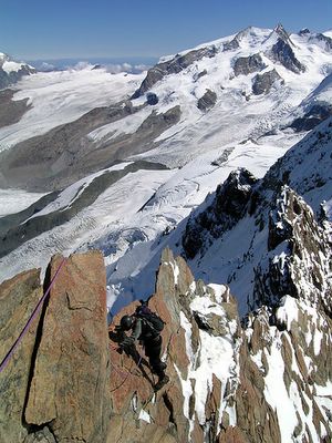
Pre-Matterhorn Training Climbs

Wednesday, October 04, 2006


At 8:30 AM on July 20th, Ashley, Daphne and I stood on the summit of the Matterhorn. Two days later, our friend and fourth climber Diana Mellon-who had to defer her big day due to a stomach virus, stood at the same place. Particular mention should also be made of Chris Mellon who, though unable to train and climb with us, also made the summit (with considerable speed!) on July 20th.

This blog and it’s sequel at http://climbingthematterhorn.blogspot.com/ are an attempt to describe in pictures the indescribable: our climb up the Matterhorn and the training days that preceded it. Click on any shot for the large version.

During all the climbs, taking pictures was not high on the list of skills our Swiss guides were attempting to instill in us. Quick shots were grabbed during the very few breaks afforded us and at the various summits. I have therefore on occasion gone outside our portfolio and borrowed pictures from other climbers of our exact routes. Not only will these shots “fill in the blanks,” but also impart to the visitor—however inadequately, some approximation of the experience. For it is impossible to capture either in words or in pictures the reality of what it is like to climb in the high alps.

I dedicate both blogs to our Swiss guides led by the incomparable Christoph Petrig, and ably assisted by his colleagues Benedict, Henri, Georg and Turbo. They were our friends, our coaches, they pushed us, they kept us safe, they taught us to believe, and they got us to the top.


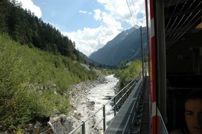
Zermatt in the valley north-east of the Matterhorn. The Swiss-Italian border bisects the summit.


Approaching Zermatt. Train only: no cars allowed.


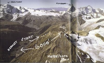
The first full training day for Ashley, Daphne, Diana and me was not with guides, nor was it a technical climb (as the others would be). It was a day hike. And it was epic. For those of you who hike, these numbers may resonate: leaving at 8:30AM, we hiked for five and half hours steeply uphill gaining 6,000 feet to arrive at the summit of the Mettelhorn. It is a hike usually attempted after an overnight stay at the Trift Hut-some 2,400 feet above Zermatt. We did the entire shot in one day.


The Trift Hut, two hours into our journey through a ravine cut between the mountain slopes on the west side of the narrow valley that cradles Zermatt. It was here that we were seduced by an elixir conjured up by the innkeeper Hugo. It consisted of one part ice tea, one part freshly squeezed orange juice, and a splatter of lemon.


Our route forward


Looking back at the Trift Hut.


An upper plateau offered a few minutes of flat walking before the final push to the snowfields and final ridge. Our mountain is not yet in sight.


Looking back from above the plateau.


Approaching the first snowfield below the ridge.


Getting closer to the ridge in deep wet snow.


Another glance back


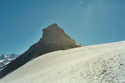
The crest of the ridge and after five hours of steep uphill hiking, we get our first look at the Mettelhorn!


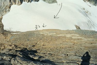
The snowfield before the summit zone was soft in the midday sun and often we would frustratingly sink to our knees and even upper thighs. Two teams returning were roped together. There were potential perils such as sliding down the steep snowfield to the nearby precipice on our left, or crevasses, but Hugo said: "Just walk in the footsteps made by others and you will be fine." And Hugo never lied to us.


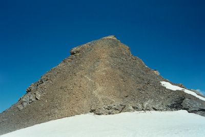
The switchback path leading up the pyramid to the summit was, shall we say, steep. We were also just on our second day in Zermatt, and though the altitude and jetlag added to our difficulties, our spirits were high approaching the summit, and there wasn't a murmur of complaint from any in our brave party!


The titular summit of the Mettelhorn is literally a point. The narrow summit ridge overhangs the cliffs above Zermatt over a mile below and made a spectacular bench for our picnic.


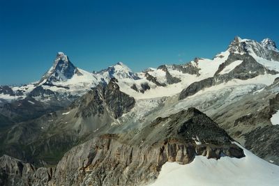
In addition to our airplane view below, we were surrounded on all sides by the citadels of gleaming snowclad mountains and glaciers, including our ultimate goal: the Matterhorn pictured here. The mountain in the foreground is the Platthorn, recommended as the alternate peak for our route should the snowfield below the Mettlehorn prove inaccessible.


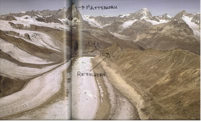
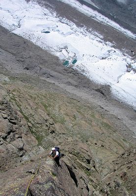
Training Day 1 with our Swiss Guides was rock climbing to the summit of the Rifflehorn.


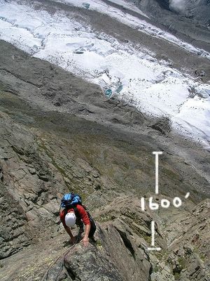
Our route went up the left side as viewed from this angle, so we were well over a 1,000 feet above the glacier below before we commenced our first pitch.


This shot depicts the 'Egg Route' taken by Daphne and Diana with their "energetic" guide Turbo. His nickname is apt. When, on a particularly narly pitch the girls yelled up to Turbo for specific guidance as to hand and foot placement (as they saw none!), his response was: "Up! Up!"


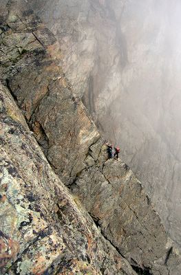
An excellent time not to fall.


This shot is of the 'Kante' route located just beside the 'Egg' route. The Rifflehorn is foremost a vertigo test. It allows the guides an immediate indication as to how the client will handle the stupendous exposure on large sections of the Matterhorn. White knuckles and gallons of perspiration are not a good sign.


The summit achieved!


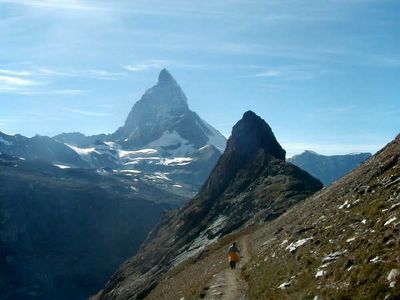
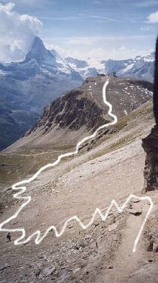
The path back to the train on the plateau side of the Rifflehorn. Notice how the Matterhorn hovers over all these training hikes with a constant reminder of why you are there. You cannot escape it's power, and it's features are so seemingly indomitable from a distance that fear and doubt are begging to be admitted into your house of emotions. We were determined to keep that door closed, but "Why is it always there, taunting us?!" we secretly thought.


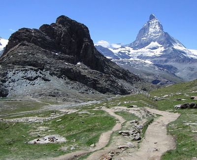
Training day 2: The Black Ridge. On the Rifflehorn, we got passing grades on the vertigo test and our rock climbing skills. But Christoph wanted to work on our overall agility climbing and moving across exposed mixed rock at altitude. At 10, 700 feet the seldom traversed Black Ridge definitely fit the bill. We took the gondola to the summit of the Unterrothorn on the east side of Zermatt and walked behind the station to our starting point. That hike is depicted here. Is the everpresent mountain in the background familiar?


As we didn't have our own camera that day, this is the only shot I could find of the Black Ridge. It was an extraordinary traverse up and down a knife-edge ridge with huge drops on both sides. The pictures following of the Breithorn Traverse will give a good idea of the experience.


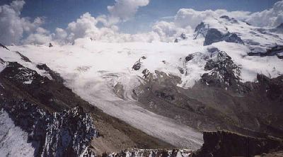
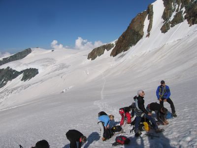
Training day 3: The Breithorn Traverse. We now had passing grades on training climbs at 3,000 meters, now it was time to pass muster at 4,000 meters. The Breithorn traverse is one of the classic climbs in the Zermatt region. At 13,500 feet it follows a narrow ridge line to the side of the Breithorn near it's summit. Here we are on the glacier behind the Breithorn putting on our crampons.


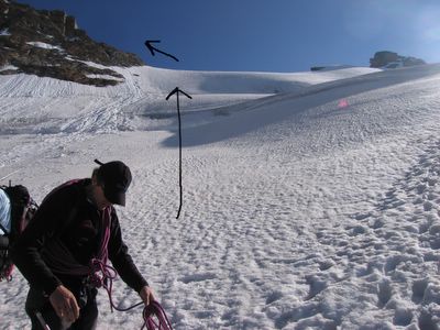
The route up. The last section prior to the ridge was very steep and required ice-axes and belaying. Benedict in the foreground makes final preparations.


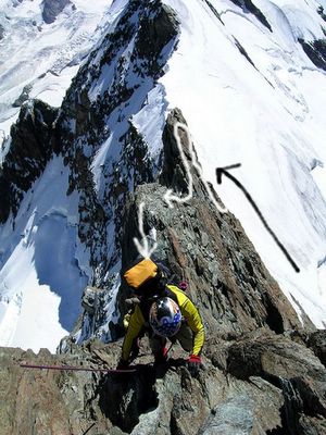
From the top of the snow ridge we removed crampons and started negotiating the rock ridge and it's many spires.


Climbing the ridge


Carefully


You could cut bread with the edge of the ridge at times.


Most of the pinnacle walls were vertical climbs.


Spire-bagging: five down, three to go.


"Now I left it here somewhere..."


The highpoint of the traverse and time for a break.


To quote Daphne's blog post: "Diana looks like an Italian movie star".


Christoph giving us a crampon-tying lesson above the clouds.


Meeting of the B's: Big Bob with the Breithorn in the background.


From whence we've come.


Training day 4 We traveled to Saas Fee and climbed the The Jegihorn: a technical rock climb. Our route is pictured here.


Approaching the Jegihorn.


On the wall to the summit. Best not to look down.


Or up for that matter.


Daphne approaching the summit with Henri who would also be her guide on the Matterhorn. Saas Fee, some 7,000 feet below, is visible over Daphne's backpack.


The summit of the Jegihorn! Daphne receives a well deserved congratulations from Henri.


Diana admiring a view that Edward Whymper--who spent 30 years travelling to every corner of the region--described as "perhaps the finest of it's kind in the Alps."


Our fearless leader Christoph Petrig (right) with his close friend Henri.


Ashley and Daphne celebrate the successful conclusion of the first half of a challenging technical rock climb. Now we had to get down! This shot also offers a glimpse of the endless scrolls of mountains visible from the Jegihorn summit.

Monday, October 02, 2006


The descent route was great down-climbing practice for the Matterhorn.